Harbin’s Station:
Location
John G. Harbin was the original station-keeper.
15 miles SW of Crouch’s
The house stood a mile SW of Washburn was burned during Civil War
A new house stood there in the 30’s owned by Mrs. S. L. Davis.
The mail road approximates Highway 37 but ran slightly east of 37
The mail road ran 25 feet east house
37 was established west of property isolating it from the flow of traffic.
So look for a location on the east side of the highway in the area across from where the current county road heads west and crosses the rail road tracks.
The mail road actually continued south along the east side of 37 for another mile and then meets up with county road 1050.
May 22, 2009
Went to Gateway and drove north looking for Harbin’s on my motorcycle with only an aerial of the area as a guide but had a pretty good idea of the location I was interested in. I knew that only an informed local was going to put me on the site.
 The Green house marks the spot of the station and the little Red E Mrs. Ellis's present home on Highway 37.
Drove up and down the highway several times and took a few side roads east of the highway. No luck. I could spot an old structure out in the pasture east of the highway and it gave evidence of where the old road might have been. Then I picked a house to just stop and ask and a nice boy came out as I was leaving and told me to try the next house down. A Mrs. Ellis might help.
Pulling into her yard I saw someone behind the house and called to her. She was completely approachable. I introduced myself and told her what I was interested in. Bingo! She immediately said something like, “I know where that is (meaning the station site) and it ain’t where everybody says it is. It’s right here.” Then she pointed over her shoulder at a hay field.
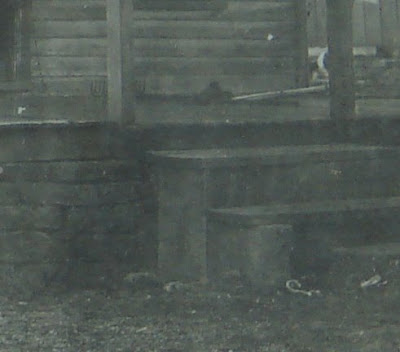
Mrs. Roberta Ellis looked to be in her late 70’s or 80’s and had kind and beautiful light blue eyes. I told her the station I was looking for was owned by a John Harbin and she said, “Well, this is the old Harbin Farm and my great grandmother was a Harbin. Her name was Virginia Harbin. She went on but I didn’t even have a note book. I asked her If she could be more specific about the location and she said, “I’ll take you right to it. There ain’t nothing left of it you know, though cause they burned it in the Civil War.” Then she went into the house and came out with a picture of a small clapboard house and said, “They built this house right back on top of the foundation.”

In this picture is Sally (McAry) Davis on the right and Pauline Henry as a child to her left. Pauline is Mrs. Ellis’s mother.
So we walked a farm road that ran right by the house as she explained that it was right where the stage road had been and indicated where it turned south towards Pea Ridge. After a couple of cattle gates we stood next to an ancient tree and a field. “Right down there, she pointed, is where the spring is.” “You know the soldiers sat there at night, North and the South, and had supper by the spring. Went back to killing each other in the morning.” My uncle blew it up with dynamite to make it bigger. Ruined it but it still flows. It used to have a nice spring box around it.” Then we turned west and she indicated in the field where the site of the old stagecoach station was. “It was right up here, course there is nothing left.” Near the old tree was a perfect foundation stone and in the grass a smaller cut stone. That was all that was left that I could find but I felt incredibly lucky to have Mrs. Ellis there to point at the exact spot. 
- On the way back to the house I explained that I hadn’t really come prepared and that I wished to come back with a note book to get some of the details and a camera to take a picture of the site and if she would allow to take a picture of her photo of the house that was rebuilt on the foundation.
She was agreeable and I told her I would call first.
When I got back home I checked the list above on known facts regarding the John G. Harbin Station. On June 5th I went back with a camera and a notepad. In my discussions with Mrs. Ellis I was able to confirm that her site satisfied all the criteria.
It was owned by a Harbin and was known as the Harbin farm.
Virginia Harbin married Bert Davis. She died after giving birth to Gertie Henry and Mr Davis remarried to Sally McCary. This could certainly be the Mrs. S. L. Davis that the Conklings reference that owned the place in the 1930’s.
The site is about a mile SW of Washburn and approximately 15 miles from
Crouch’s. - It was known to have been burned at the time of the Civil War.
- It is east of highway 37 and it faced the old road which ran to the east of the site.
- It had a good spring very close for watering the horses.
- It has the continuity of the oral history of the family still living there.
Mrs. Ellis also explained that she was familiar with the Harbin place often referred to as the station which is on FR 1050 not far from there and across the railroad tracks. Farm Road 1050 (Also known as Rock Springs Road) does approximate the mail road and heads off down Washburn Hollow and eventually into Arkansas and on to Pea Ridge. But the house that is marked by a standing stone chimney is not the station. I have seen the place and taken pictures of it. It is also marked as the station in Donald Minke’s book and he shows a picture of the chimney. Mrs. Ellis was quite clear that this was not the station. Also it was not owned by a Davis in the 1930’s and the Conklings were quite clear that the old road continued further south on the east side of Highway 37 for another mile past the Stage Station site before angling west to connect with the CR 1050. The chimney site is on the west side of highway 37.

Here is a picture of the Spring on the west side opposite the house site.

And here is a picture of the Old Tree and the large foundation stone near it.

I don't know that it means much but it is interesting that this stone looks to be the same shape and size and style as the one under the front steps of the of the Sally Davis house pictured above.